Position: 51° 20.9′ N / 03° 12.1′ E
Internationale Reg.: B 0122
Tragweite: weiss 20 sm, rot 18 sm
Erbaut: 1905 und 1908 repariert.
Turmhöhe: ca. 8 m
Feuerhöhe: 22 m
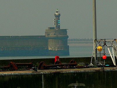 Fotos 2010: Bernd Claußen
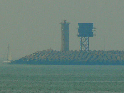
Aus großer Entfernung bei Nebel fotografiert.
Position: 51° 21.9′ N / 03° 11.9′ E
Internationale Reg.: B 0123
Tragweite: rot 7 sm
Erbaut: 1905
Turmhöhe: 30 m
Feuerhöhe: 31 m
| Nr. | Seaside (E&W) | Landside (W) | Significance | |
| 1. | Serious emergency. All vessels stop or divert according to instructions | HARBOUR CLOSED- SERIOUS DANGER | ||
| 2. | Entering prohibited. Leaving prohibited. | HARBOUR CLOSED | ||
| 3. | Entering prohibited. One way traffic outward allowed. | OUTGOING | ||
| 4. | One way traffic inward allowed. Leaving prohibited. | INGOING | ||
| 5 | Vessels may proceed. Two way traffic. | FREE PASSAGE | ||
| 6. | Entering allowed only with specific permission to do so. Leaving prohibited. Incoming vessel for LNG-terminal. | LNG-CARRIER IN | ||
| 7. | Entering prohibited. Leaving allowed only with specific permission to do so. Vessel leaving the LNG-terminal. | LNG-CARRIER OUT |